Everything you ever thought about cartography is wrong. Or so argues Matthew Edney in this intellectually bracing and marvellously provocative account of how the mythical ideal of cartography developed over time and, in the process, distorted our understanding of maps – a concept that Edney also gives a run for its money. It might seem perverse that the director of the University of Chicago’s History of Cartography project should begin by claiming “there is no such thing as cartography” and conclude by hoping, if it does exist for some, to “at least severely injure it”. But there are good reasons why Edney is calling time on the name of the discipline he appears to lead.
When the first of the eight volumes of The History of Cartography came out in 1987, its editors, J. B. Harley and David Woodward (Edney’s research supervisor), transformed the subject because Harley, a respected scholar of the Ordnance Survey, discovered French post-structuralist theory and began “deconstructing” maps as subjective, ideological instruments. He criticised what Edney calls the “normative” approach to maps as rational, transparent, scientific representations of the world. The result was to produce a scholarly and rigorous cartographic history that drew on sociocultural perspectives to broaden the definition of maps as “graphic representations that facilitate a spatial understanding of things, concepts, conditions, processes, or events in the human world”.
Acknowledging his debt to The History of Cartography as the standard reference work in the field, Edney argues that our definition of “the map” (with a definite article) is based on the myth of cartography as a universal ideal, common to all humanity, when it was in fact an invention of 19th-century European industrialised societies, subsequently refined, naturalised and now “triumphant”, enshrined within today’s map-making agencies and the academy. Both normative and sociocultural approaches to mapping have accepted the assumptions of this ideal, which has misunderstood the sheer variety of mapping practices, lumping them together under the single term “map”. As a result, “we should abandon the critique of maps, whether normative or sociocultural, and engage instead in a critique of the ideal of cartography” because it “depicts what mapping should be, not what it is”.
But perhaps inevitably, after this conclusive dismantling of the myth of cartography, what mapping is proves a little harder to define. Edney expands yet also condenses Harley and Woodward’s definition, arguing simply that “‘mapping’ is the representation of spatial complexity”, and “‘map’ is a text representing spatial complexity”. On these terms, maps are the integration of words, graphics, numbers, artefacts, even gestures, multicomponent “things”. Drawing on semiotics, communications theory and book history, Edney argues for a processual analysis that rejects maps’ individual authorship and chronology, instead seeing their meaning – and even dating – defined by the reception of a community of users who read them like books and use them like instruments. Building on collaborative work undertaken on The History of Cartography, Edney identifies no fewer than 14 “modes of mapping”, from modern state-driven practices, including geodetic and boundary mapping, to “coarser resolution mapping” of spaces such as the heavens, the seas and the whole world. Although these modes can often overlap – Mercator’s famous 1569 world map can also be understood as what Edney calls marine mapping, because of its explicit use in maritime navigation – there are fundamental differences between each mode in how they conceptualise spatial knowledge. We misunderstand their form and function if we reduce them to a singular language and a timeless ideal of cartography.
Edney goes even further in offering a “checklist” of no fewer than 58 “wrong convictions sustained by the ideal” of cartography. He insists that maps are not “an unmediated, graphic, mimetic representation of the world” and rejects the assumption that “cartography is a singular endeavour pursued by all map makers”. Such prescriptiveness can feel at odds with the more subtle, processual approach that Edney otherwise champions, especially when so many items on his checklist of misconceptions would be obvious to his intended readers (would any of them still believe that “the map is a mirror of nature”?). But it is driven by a profound grasp of the history of mapping that repeatedly and convincingly exposes the contradictions and paradoxes of cartography that have fuelled so many misunderstandings and flawed interpretations.
The first half of the book’s polemic is underpinned by the second half, which provides a dazzling account of how the cartographic “ideal” came into being over the past 200 years. Edney identifies how “cartography” emerges as a neologism in the first decades of the 19th century, developed by those working in the field of early nation state mapping and learned geographical societies to give the concept a veneer of rationality and scientific rigour. It was defined as “the universal endeavour of the direct and coherent measurement of the earth’s curved surface and its reduction to a plane surface”, an ideal from which all earlier – and subsequent – mapping is measured (and often found wanting, much to Edney’s understandable consternation). The survey of how this ideal entwined the state’s investment in national mapping organisations with changes in science, the rise of imperial mapping and the mass consumption of maps is quite brilliant. It culminates in the book’s most profound and challenging argument: that scale, expressed as a numerical ratio (1:x), is an incoherent method to apply to all maps and reveals how the cartographic ideal of an absolute map-to-world proportionality leads to calamitous misunderstandings.
To challenge such an apparently unquestionable cornerstone of map-making as scale is symptomatic of the ambition and, well, scale of Edney’s book. He has convincingly overturned the presumptions of an entire discipline and those who both practise and study it, all of whom will need to assimilate and respond to this work in order to understand the future of mapping and cartography as a concept. It deserves to generate much debate and undoubted controversy, but I am sure that Edney will be up to for the conversation (especially since, under his forensic eye, nearly all of us within the field come in for censure at some point!).
Inevitably, there are issues and questions. There is not much on the shift to digital online mapping and “neocartography” (mapping produced by users outside professional mapping organisations). Edney tries to displace “scale” with what he calls “resolution”, but it is unclear how this would affect map production. And although he tacitly acknowledges that his project is focused on European cartography, it would have been fascinating to hear him reflect on non-Western mapping. There will also be queries about what is left now that Edney has tipped the cartographic baby out of the hydrographic bathwater.
We “must stop saying ‘maps are’ and instead say ‘X mapping is’,” he concludes. Cartography, it seems, is dying; what arises from the ashes remains unclear, although Edney will undoubtedly remain at the heart of navigating our way through the seductive, perplexing and endlessly changing landscape of maps. Whatever that is.
Jerry Brotton is professor of Renaissance studies at Queen Mary University of London and the author of A History of the World in 12 Maps (2013) and, with Nick Millea, Talking Maps (2019), published to accompany the eponymous exhibition at the Bodleian Library, Oxford, running until 8 March 2020.
Cartography: The Ideal and Its History
By Matthew H. Edney
Chicago University Press, 328pp, £68.00 and £23.00
ISBN 9780226605548 and 9780226605685
Published 12 April 2019
The author
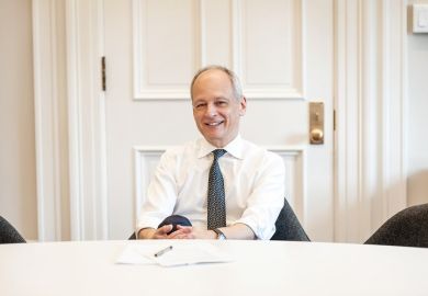
Matthew H. Edney, professor of geography and Osher professor in the history of cartography at the University of Southern Maine, was born in London and grew up in the borough of Kingston upon Thames. He studied geography at UCL with a view to becoming a surveyor but there, he recalls, discovered “historical geography” and found a way of bringing together these two interests in the history of cartography. He went on to study map history with David Woodward at the University of Wisconsin-Madison for his MS and PhD.
Even as a student, Edney goes on, he was “dissatisfied with the simple progressive narrative constructed for the history of cartography”, and his first overtly conceptual essay was about “how to tell the history of cartography without succumbing to those narratives”. He built on this in a number of historiographical and conceptual essays where he tried to work through all the issues he covers in his book.
Asked about the crucial common misconceptions about maps and mapping that he wants to challenge, Edney flags up three. Most basic is “the conviction that there is such a thing as ‘the map’ ”. Rather, “there are multiple representational strategies for mapping (for communicating spatial complexity) that feature graphics, words, physical installations, numbers, so that ‘map’ is indefinitely variable.”
Equally misguided is the idea that “maps are only graphic reductions (‘reduced homologues’) of the world, and are to be judged solely by how well they reproduce the world in parvo. All maps are intellectual as well as instrumental, imaginative as well as factual, biased as well as truthful.”
Finally, it is important to resist “the assumption that all maps are made to assist in navigation, even low-resolution maps of regions and the world. Guidance for travellers is important, yes, but most kinds of maps are about conceptions and ideas.”
Matthew Reisz
POSTSCRIPT:
Print headline: Into uncharted territory
Register to continue
Why register?
- Registration is free and only takes a moment
- Once registered, you can read 3 articles a month
- Sign up for our newsletter
Subscribe
Or subscribe for unlimited access to:
- Unlimited access to news, views, insights & reviews
- Digital editions
- Digital access to THE’s university and college rankings analysis
Already registered or a current subscriber?


